history of the house
|
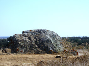
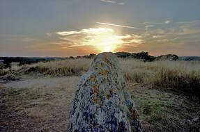
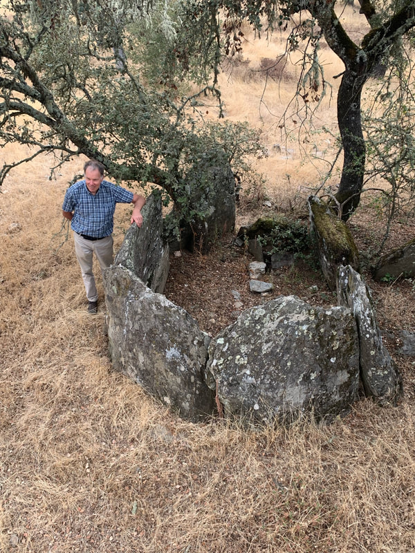
The history of the house starts at least 6000 years ago: the rock on the hill, 50 meters from the main house, points exactly to the spot on the horizon where the sun sets on 21 June. It is quite possible that this rock was used for calendar ceremonies. It is certain that people lived here 6000 years ago, evidenced by the prehistoric graves some hundred meters from the house. The intriguing bowls carved into the wall of a canyon at 1 km from our house also seem to testify to prehistoric habitation.
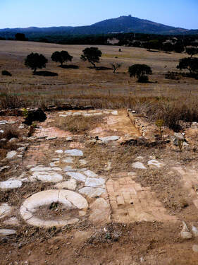
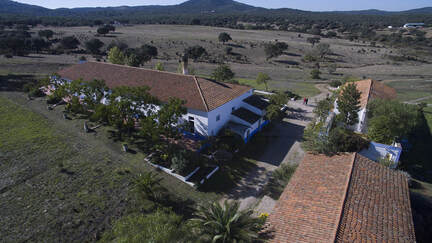
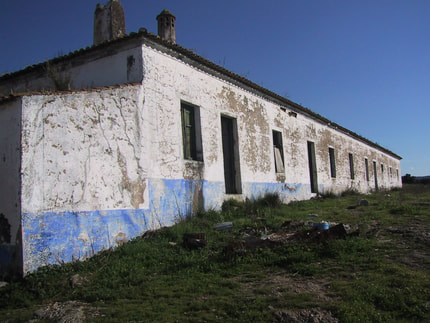
Near to this "Solstice-rock" we discovered the remains of a large, 250-year-old house. And we try to find proof for the expectation that this house was built on top of something of Roman origin. What is certain is that the Roman “highway” between Merida and Evora had a secondary road close to our house: a Roman milestone was found several hundred meters from our house. Our house: Monte da Marmeleria was built 200 years ago, probably with the stones that came from a quarry where we now have the swimming pool and from the above-mentioned ruin. The estate of Marmeleira originally encompassed many thousands of hectares producing wheat, cattle, pork and charcoal. Bit by bit we have started to understand how people worked, lived and feasted. But a lot is still a mystery. Up to around 60 years ago Marmeleira had a permanent staff of 30, a lot of local contractors and during the grain harvest an extra 80 workers, mainly from Trassos Montes. The current activities hall was probably used for cooking and sleeping. Because a significant part of the salary was paid in bread and wine (5 liters per day), there must have been a lot of singing and dancing after the working hours. Local senior citizens remember those times with nostalgia. Although Marmeleira played a key role in the region, with its own grain mills, a house chapel and cattle trade contacts with Spain, life was very sober: there was never electricity, running water or sanitation. Marmeleria had its own flour mills. Their ruins are on walking distance from the house. They are both spooky as intriguing. The mills used water power of the River Tera. This seems difficult to believe, as the river contains little water. But only 30 years ago it had a strong current. Marble mining, eucalyptus plantations and farmers building private artificial lakes are among the causes of a lack of water. Transport and work was mainly done with oxen. An oxen manager had two couples, one for the morning and one for the afternoon. Unlike horses or dogs oxen are stupid. You can’t teach them anything by punishment and reward. But the oxen managers found a solution: they sang for them! Each oxen, according to his guardian, had its own musical preference. Sometimes the song was invented by the oxen driver himself. About 50 years ago the Herdade lost it competitive force. Farming on more productive and less laborious land in Portugal and abroad was more profitable. The Monte was abandoned, doors and hatches were used as firewood and the roof collapsed. Cows and sheep of the local shepherd were the new guests of the house. In 2003 we arrived to live and work here. We brought electricity, water and sanitation facilities, we gave the house a new roof and changed windows into doors. But the basic architectural structure and most of the building material is still just as it was 200 years ago. |
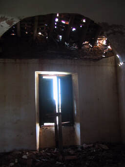
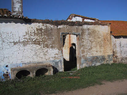
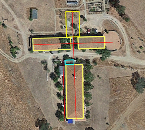
About 50 years ago the Herdade lost it competitive force. Farming on more productive and less laborious land in Portugal and abroad was more profitable. The Monte was abandoned, doors and hatches were used as firewood and the roof collapsed. Cows and sheep of the local shepherd were the new guests of the house. In 2003 we arrived to live and work here. We brought electricity, water and sanitation facilities, we gave the house a new roof and changed windows into doors. But the basic architectural structure and most of the building material is still just as it was 200 years ago. Another mystery is the floor map of our house: see the image below. According to Antonio Tavares it has some similarity with the floor map of a church. There are several options to interpret this feature.
The most obvious is “co-incidence”, for no special reason and with no link to a previously built structure. It is for certain that the placement of the buildings is at least partly based on using existing rock formations as cornerstone or strengthening walls. Another possibility is that the builder and owner had a goal: he gave the floor map the shape of a church to gain divine blessings or to show off as a religious person. The most intriguing option is of course that the current building was built on top of the ruins of a church (and if so, that this church was built on top of something else). Intriguing indeed, but it has to be said that we found no proof for it as yet. This church or convent must have been very big. But as far as we know no historical documents exist that tell about it. And when digging the soil we still did not find artifacts that support this option. On the other hand, we have many indications for habitation of our locality for many centuries, may be even millennia. So, we parked this mystery is parked in the category “dilemma”: not finding proof, does that mean tat it does not exist or that we did not dig enough. |
